
After enjoying numerous walks by the Brighton seafront and the South Downs in East Sussex since January 2019, in August 2020 I returned to Finland to start a new postdoctoral project titled Producing and mobilizing geographical knowledge in Finnish society, c. 1850-1940 at the University of Helsinki. The three-year project, funded by the Academy of Finland, enables me to dive into the piles of maps, atlases and geographical texts that enabled Finns to know the world beyond Europe during a period when only the few had the opportunity to travel and explore these areas in person.
One of the inspirations for the project was my somewhat random encounter with the first Finnish language map of the world on the website of Kotimaisten kielten keskus. The map, published in 1845, appeared as a supplement to the first volume of Lukemisia Suomen Kansan hyödyksi, a series edited by journalist Paavo Tikkanen. The map was published with an article that provided its readers an introduction to general geography (Johdatus Yleiseen Maa-tietoon). The first Finnish map of Europe had been published only some twenty years before in 1821, also as a supplement. This map appeared in Turun Wiikko-Sanomat, a magazine published in southern Finland by Reinhold von Becker.
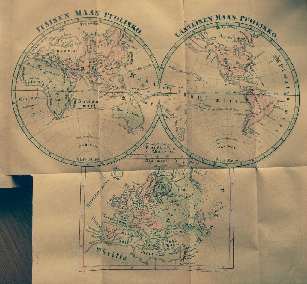
When zooming in and out the world map and reading through Tikkanen’s introduction of world geography, I began to wonder about the people who had perused the map in the 1840s and travelled the contours of the world with its help. I wondered how many cut out the map, as Tikkanen suggested, and pinned it on a wall to study it later in reference to everything else they came to know about the distant parts of the globe? What did they learn about these places, how, where and why?
These questions guided me in developing a research proposal that combines together perspectives from the history of knowledge, historical geography, material culture research and the study of print culture to examine the changes and continuities in the geographical imaginations in Finnish society. The period I am concerned with, roughly between the 1850s and the 1903s included the expansion of European empires, the growth of the global protestant missionary project (which the Finns partook with their own Finnish Missionary Society), the establishment of geographical societies (the Finnish Geographical Society was founded in 1888) and Finnish mass-migrations especially to North America. Mass-education was introduced, with the growth of mass-literacy. Cheaper printing technologies and new methods of documenting the world (especially photography) transformed the ways of transmitting knowledge. Literary Finnish developed into its modern form during the nineteenth century, and Finland gained its independence from the Russian Empire in 1917. All these historical processes had their impact on the geographical knowledges that were produced and mobilized in different forms in the Finnish society.
In addition to blogging about the general progress of my research, I will be posting separate “object biographies” concerning some of the maps, globes, books and atlases that I encounter during my work. I am looking forward to sharing with you what I find as my project advances!
