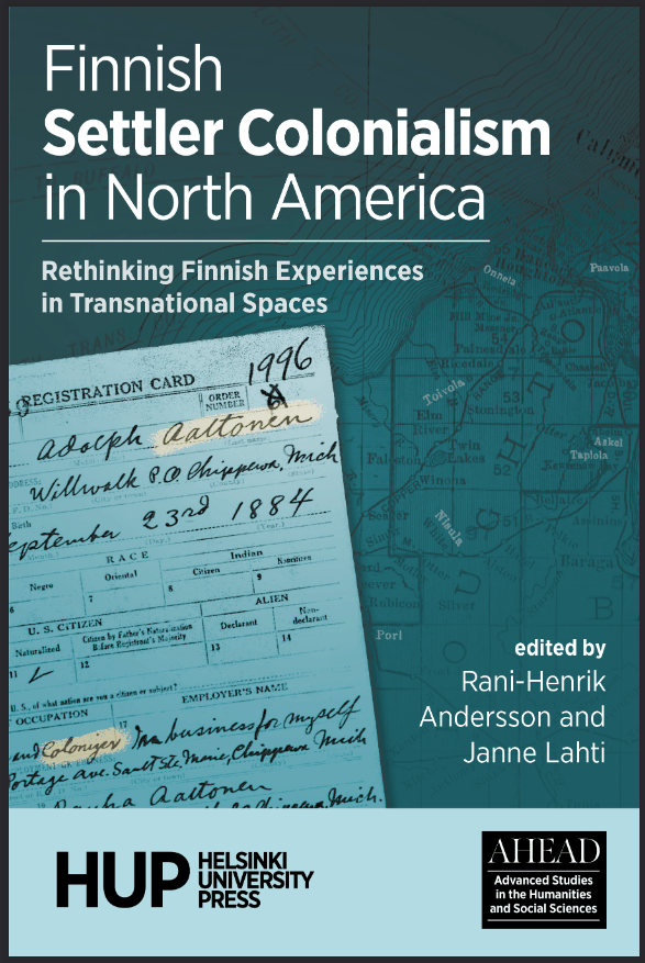
Hot off the press is my contribution to an edited collection entitled Finnish Settler Colonialism in North America: Rethinking Finnish Experiences in Transnational Spaces (Helsinki University Press 2022), edited by Rani-Henrik Andersson and Janne Lahti. The book and its contributions seek to reexamine Finns in North America by situating them in the context of global settler colonialism. For the book I wrote an article that examines what popular geographical publications, published at the end of the nineteenth and early decades of the twentieth century, reveal about the shaping of Finnish geohistorical imaginations concerning the roles of Finns in settling the United States. The article examines how, why, and what types of maps and geographical knowledge were utilized to document and represent the historical roots of Finns in America and make them visible on the map of the United States. I argue that the geographical texts and maps were tools for Finns and Finnish Americans to make claims for spaces on the North American terrain and to showcase how they too had contributed to “civilizing” the lands and building the settler colonial society, past and present. I contextualize the maps and geographical texts within the colonial cartographic frame where the roles of Europeans as “discoverers” were emphasized and Indigenous land use and geographical knowledge became marginalized.
August is here and with it comes the anticipation of the start of a new academic year. Therefore, it is perfect moment to reflect on the past year and how I have progressed with my research. I am currently two-thirds into my current project – September will mark the beginning of the final year. The past two years have been shadowed by the pandemic – prohibiting or postponing many of my planned travels abroad. However, as most of the primary sources that I am studying are located in Finland, I have been able to proceed with my research almost as planned. Due to the restricted opening hours and limited seats at the archives, working with some material has been incredibly slow and forced me to find alternative perspectives using digitized materials. This has led to many interesting discoveries, especially regarding how different types of maps were discussed in the press, how they were marketed and what types of maps were available during the different decades of the latter half of the nineteenth and the early twentieth century.
Indeed, newspapers and periodicals are an incredibly rich source to understand the availability of different types of maps and geographical publications, to understand what their relative prices were and who may have purchased them. One example that I have researched during the past year are the maps that were incorporated in specialized periodicals such as those published by the Finnish Missionary Society for children and adults. These maps, the reading instructions, and the geographical information that was distributed with them shed light on the ways that institutions other than schools shaped people’s geographical imaginations and map literacy. Another case study that I have focused on is the ten-volume-book-series called Maapallo, that was published in the 1920s by Otava, a major Finnish publishing house. In this case too, the reviews in the press and the advertising of the volumes that are available digitally provided something to work with while accessing the sources in the archives was difficult.
In addition to this short summary of the past year and the topics I have research, I want to highlight two important events that took place in May-July regarding the history of maps and cartography. The first is the course on the history of maps and mapping that I organized at the Open University at the University of Helsinki. The lecture course featured multiple lecturers and students got an introduction to the historical study of maps and mapping. The course was held in hybrid mode, although after the first lecture most students chose to follow the course via Zoom. This was the first time that put together a course on this theme and chose to approach the topic from a variety of different perspectives. These included past and current approaches to the study of maps and cartography, medieval maps and world views (taught by Stefan Schröder), Renaissance maps and atlases (taught by Marjo T. Nurminen), different types of early modern maps of the Finnish maps and their revelance to archeological research (taught by Georg Haggrén), Indigenous maps (taught by Joy Slappnig), maps, colonialism and European empires (taught by myself), maps in war (taught by Erkki-Sakari Harju) and maps and imagined communities (taught by myself). A mixed collection of themes that reflected the expertise of the lecturers.
During the course, students were assigned readings and mini studies of maps. I also organized them to visit a map exhibition either live or online. The goal of these smaller assignments was to support the students learning during the course and inspire them to find the topic of the final assignment, which was a research essay on the map or maps or their choice. From the teacher’s perspective, this structure seemed to work well, and some students confirmed this in their feedback. For others, according to their feedback, this seemed to make the course too heavy.
Looking back at the course and how it unfolded during summer weeks from early May to the Midsummer in June, my first impression is the difficulty of how to approach such a wide topic. My own expertise covers only a portion of the theme. Relying on knowledgeable colleagues is therefore crucial. However, based on my experience from this course, the topic would benefit from a more hands-on approach alongside the lectures that give the context and present theoretical perspectives. Perhaps I should next develop a practical course on map history. One student hoped for a course on the maps and mapping of Finland and the Nordic countries – such a theme is a possibility too. Now, I am still eagerly waiting for the final essays from the students. Reading these will show me what the students have learned about the studying the history of maps and mapping.
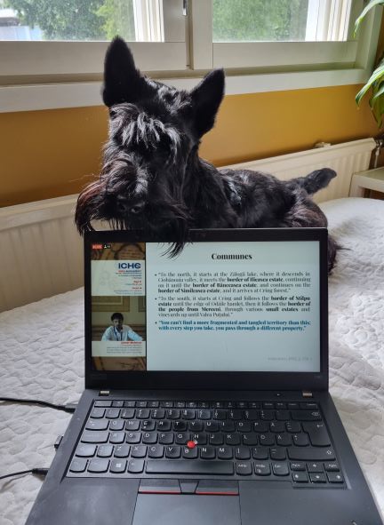
The other event worthy of noting is of course the 29th International Conference on the History of Cartography, which was held in Bucharest, Romania on the first week of July. The ICHC’s are the only conferences dedicated entirely to the history of maps, mapping and cartography. The theme of this year’s conference was conflict and cartography, a well-suited topic that allowed for the study of maps from various periods and contexts. At the conference, I had the great opportunity to share my research on the Finnish Missionary Society’s world maps, and as always, to learn from other people’s research. Even though the hybrid format had its challenges, it was great to be able to participate remotely. I do, however, look forward to participating the next conference in person!
Participating the ICHC 2022 from the home office had its benefits.
Pääsin kertomaan tämän hetkisestä tutkimushankkeestani Maantieteellinen tieto suomalaisessa yhteiskunnassa Sanojen liike -podcastissa. Juttutuokiossa Janne Tunturin kanssa käydään läpi hankkeen tavoitteita, taustoja ja tähänastisia tuloksia. Jakso on kuunneltavissa Spotifyssa.
I wrote a review article for the Finnish open access journal Ennen ja nyt: historian tietosanomat on the postrepresentational, processual and biographical approaches to the study of maps and mapping. The article analyses three recent publications concerned with these approaches, namely Christian J. Koot’s A biography of a map in motion: Augustine Hermann’s Chesapeake (New York University Press, 2018), Martin Brückner’s The Social lives of maps in America, 1750–1850 (Omohundro Institute of Early American History and Culture and the University of North Carolina Press, 2017) and Mapping, connectivities and themaking of European Empires (Rowman & Littlefield, 2021), edited by Luis Lobo-Guerro, Laura Lo Presti, and Filipe dos Reis.
The article (in Finnish) is available open access here.
After enjoying numerous walks by the Brighton seafront and the South Downs in East Sussex since January 2019, in August 2020 I returned to Finland to start a new postdoctoral project titled Producing and mobilizing geographical knowledge in Finnish society, c. 1850-1940 at the University of Helsinki. The three-year project, funded by the Academy of Finland, enables me to dive into the piles of maps, atlases and geographical texts that enabled Finns to know the world beyond Europe during a period when only the few had the opportunity to travel and explore these areas in person.
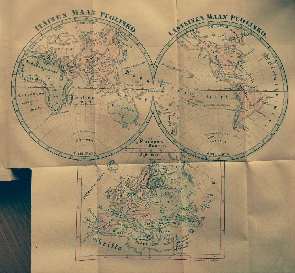
One of the inspirations for the project was my somewhat random encounter with the first Finnish language map of the world on the website of Kotimaisten kielten keskus. The map, published in 1845, appeared as a supplement to the first volume of Lukemisia Suomen Kansan hyödyksi, a series edited by journalist Paavo Tikkanen. The map was published with an article that provided its readers an introduction to general geography (Johdatus Yleiseen Maa-tietoon). The first Finnish map of Europe had been published only some twenty years before in 1821, also as a supplement. This map appeared in Turun Wiikko-Sanomat, a magazine published in southern Finland by Reinhold von Becker.
The first Finnish language map of the world (Image credit Kotuksen arkisto, available at Kotimaisten kielten keskus).
When zooming in and out the world map and reading through Tikkanen’s introduction of world geography, I began to wonder about the people who had perused the map in the 1840s and travelled the contours of the world with its help. I wondered how many cut out the map, as Tikkanen suggested, and pinned it on a wall to study it later in reference to everything else they came to know about the distant parts of the globe? What did they learn about these places, how, where and why?
These questions guided me in developing a research proposal that combines together perspectives from the history of knowledge, historical geography, material culture research and the study of print culture to examine the changes and continuities in the geographical imaginations in Finnish society. The period I am concerned with, roughly between the 1850s and the 1903s included the expansion of European empires, the growth of the global protestant missionary project (which the Finns partook with their own Finnish Missionary Society), the establishment of geographical societies (the Finnish Geographical Society was founded in 1888) and Finnish mass-migrations especially to North America. Mass-education was introduced, with the growth of mass-literacy. Cheaper printing technologies and new methods of documenting the world (especially photography) transformed the ways of transmitting knowledge. Literary Finnish developed into its modern form during the nineteenth century, and Finland gained its independence from the Russian Empire in 1917. All these historical processes had their impact on the geographical knowledges that were produced and mobilized in different forms in the Finnish society.
In addition to blogging about the general progress of my research, I will be posting separate “object biographies” concerning some of the maps, globes, books and atlases that I encounter during my work. I am looking forward to sharing with you what I find as my project advances!