Another year with maps

August is here and with it comes the anticipation of the start of a new academic year. Therefore, it is perfect moment to reflect on the past year and how I have progressed with my research. I am currently two-thirds into my current project – September will mark the beginning of the final year. The past two years have been shadowed by the pandemic – prohibiting or postponing many of my planned travels abroad. However, as most of the primary sources that I am studying are located in Finland, I have been able to proceed with my research almost as planned. Due to the restricted opening hours and limited seats at the archives, working with some material has been incredibly slow and forced me to find alternative perspectives using digitized materials. This has led to many interesting discoveries, especially regarding how different types of maps were discussed in the press, how they were marketed and what types of maps were available during the different decades of the latter half of the nineteenth and the early twentieth century.

Indeed, newspapers and periodicals are an incredibly rich source to understand the availability of different types of maps and geographical publications, to understand what their relative prices were and who may have purchased them. One example that I have researched during the past year are the maps that were incorporated in specialized periodicals such as those published by the Finnish Missionary Society for children and adults. These maps, the reading instructions, and the geographical information that was distributed with them shed light on the ways that institutions other than schools shaped people’s geographical imaginations and map literacy. Another case study that I have focused on is the ten-volume-book-series called Maapallo, that was published in the 1920s by Otava, a major Finnish publishing house. In this case too, the reviews in the press and the advertising of the volumes that are available digitally provided something to work with while accessing the sources in the archives was difficult.

In addition to this short summary of the past year and the topics I have research, I want to highlight two important events that took place in May-July regarding the history of maps and cartography. The first is the course on the history of maps and mapping that I organized at the Open University at the University of Helsinki. The lecture course featured multiple lecturers and students got an introduction to the historical study of maps and mapping. The course was held in hybrid mode, although after the first lecture most students chose to follow the course via Zoom.  This was the first time that put together a course on this theme and chose to approach the topic from a variety of different perspectives. These included past and current approaches to the study of maps and cartography, medieval maps and world views (taught by Stefan Schröder), Renaissance maps and atlases (taught by Marjo T. Nurminen), different types of early modern maps of the Finnish maps and their revelance to archeological research (taught by Georg Haggrén), Indigenous maps (taught by Joy Slappnig), maps, colonialism and European empires (taught by myself), maps in war (taught by Erkki-Sakari Harju) and maps and imagined communities (taught by myself). A mixed collection of themes that reflected the expertise of the lecturers.

During the course, students were assigned readings and mini studies of maps. I also organized them to visit a map exhibition either live or online. The goal of these smaller assignments was to support the students learning during the course and inspire them to find the topic of the final assignment, which was a research essay on the map or maps or their choice. From the teacher’s perspective, this structure seemed to work well, and some students confirmed this in their feedback. For others, according to their feedback, this seemed to make the course too heavy.

Looking back at the course and how it unfolded during summer weeks from early May to the Midsummer in June, my first impression is the difficulty of how to approach such a wide topic. My own expertise covers only a portion of the theme. Relying on knowledgeable colleagues is therefore crucial. However, based on my experience from this course, the topic would benefit from a more hands-on approach alongside the lectures that give the context and present theoretical perspectives. Perhaps I should next develop a practical course on map history. One student hoped for a course on the maps and mapping of Finland and the Nordic countries – such a theme is a possibility too. Now, I am still eagerly waiting for the final essays from the students. Reading these will show me what the students have learned about the studying the history of maps and mapping.

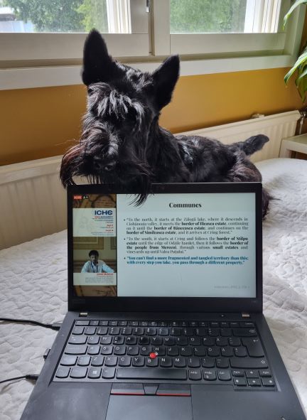
The other event worthy of noting is of course the 29th International Conference on the History of Cartography, which was held in Bucharest, Romania on the first week of July. The ICHC’s are the only conferences dedicated entirely to the history of maps, mapping and cartography. The theme of this year’s conference was conflict and cartography, a well-suited topic that allowed for the study of maps from various periods and contexts. At the conference, I had the great opportunity to share my research on the Finnish Missionary Society’s world maps, and as always, to learn from other people’s research. Even though the hybrid format had its challenges, it was great to be able to participate remotely. I do, however, look forward to participating the next conference in person!

Participating the ICHC 2022 from the home office had its benefits.

Teaching with virtual posters: experiences from a course on the history of knowledge and science 

As explained in the previous post, in September-October 2021 I taught a lecture course “Knowledge and Science in the European Empires in the 19th Century: Expeditions, Collections and Biopolitics” at the University of Helsinki. The focus of the course was on the importance of knowledge and science in the internal and interplay of European empires in the 19th century. During the course, we looked at the role of expeditions, scientific institutions, museums and various collections in producing information about European colonies and their inhabitants. In addition, we examined the role of different disciplines (such as geography, medicine, and ethnography) and discussed the knowledge practices that grounded the governance of the overseas territories.

One of the main tasks for the students during the course was to prepare a scientific poster and a video presentation in groups. As the course was held online, I organized a virtual poster session where students had the opportunity to listen to each other’s presentations and get to know the posters of the other groups. Therefore, in addition to relying on Zoom for the main part of the course, I utilised a platform called GatherTown to organize the poster session. In this post I describe the key issues that relate to organizing a virtual poster session.

Gather Town as a platform for a virtual poster session

The course consisted of seven thematic lectures for which students did six preliminary assignments. After the lecture part, the course moved on to group work, with the aim of making a poster of a free-choice topic related to the course theme and preparing a ten-minute presentation that they recorded. During the group work phase of the course, I booked one separate time to allow students to participate in a virtual poster session on the Gather Town platform.

Gather Town is a browser-based virtual environment where participants can move around the space created by the organizer; in the context of this course this was a poster room created for a poster session. During the corona pandemic, Gather has been used, for example, as a platform for conference poster sessions and also as a free-form discussion area. I chose Gather Town because 1) I didn’t want to have the presentations on Zoom, but rather 2) allow students to listen to the presentations at their own pace and 3) support the development of students’ skills in pre-recording the presentations.

Gather Town was also suitable to try on this course because the platform in question is free for groups of less than 25 people. For larger user groups, the platform charges different fees.

Gather Town does not record the sessions of its users or sell the information provided during the deployment of the platform to third parties. The more detailed security and privacy guidelines can be found here.

The basic requirement for using Gather is that you create a room that has poster walls and screens for listening and watching the presentations, topped with the amount of furniture, flowers and other elements of your choosing. The poster room is probably one of the simplest spaces that can be created and the hardest part in designing it is deciding where to place the necessary elements. Quite easy!

Each user navigates in that room with a virtual character (avatar) that they have to create and name when joining the platform. There is plenty to choose from in terms of characters – I ended up with a character wearing a top hat. When users move around the room they can chat with each other once they are close enough. Likewise, the users are able to view the posters and listen to the presentations when they move close enough to the poster wall or the screen. It would also be possible for users to share a screen and connect a video call, for example, but I did not use these features myself during the course.

Image 1: The top-hatted teacher waits for students to arrive in the poster room. The posters have been placed to the poster boards and the presentations have been linked to the screens. The students are able to view and listen to them once they step close enough. Screen shot: Johanna Skurnik

For the needs of the course, I created a small room where I could easily place the seven posters made during the course. I uploaded the posters to the poster walls in image format (jpg / png). I linked the pre-recorded MP4 presentations to separate screens. To upload the videos, I asked the students to return them to the folder I created on OneDrive, from where I uploaded them to Vimeo (Youtube is another option). The videos had to be uploaded to Vimeo because Gather requires that you link the videos to the platform – so you do not upload them to Gather. It is also possible to have the poster presentations live at Gather Town, thus avoiding the need to upload them to Vimeo or Youtube. I kept the videos secret in Vimeo and removed them from the service at the end of the course.

Students join the poster session by clicking an invitation link that I sent them (it is possible to set an additional password). You can set an expiration date for the invitation link: I set the room open for seven days. The student who receives the invitation link transfers to the room you have created after a short tutorial, which will provide sufficient information to navigate the spaces created on the platform. There is a chat channel on the platform where you can chat with students individually or send a message to everyone in the room.

In the poster session, students could tour the room at their own pace, watching posters and listening to presentations, and talking to each other and the teacher. Since the room was open for a week, students were able to return there to listen to presentations even after the poster session.

Image 2: The platform has a chat that you can use to message everyone or individual participants. Screen shot: Johanna Skurnik.

Feedback and experiences

After the poster session, we went through the posters during one Zoom session, where each group gave feedback to another group and received feedback on their own poster and presentation. To help with the feedback, the students had a poster and presentation evaluation matrix and a related set of questions. In addition to oral feedback, students also use Moodle’s workshop function to evaluate their own and others posters. In this way, the course provided practice in giving and receiving feedback and developing the students’ self-assessment skills on several occasions. I believe these assignments helped students internalize points related to communicating information effectively (e.g., what visualization works and what does not, what is the relationship between presentation and poster, how to crystallize information, etc.).

Based on the feedback gathered during the course and the overall course feedback, students seemed to like the poster as a task and considered Gather Town to be a fun learning environment. Students said the platform is easy to use and a nice variation on Zoom. From a teacher’s perspective, guiding the making of posters as well as trying out a new kind of virtual platform was refreshing. Prior to this course, I had no previous experience with Gather Town, but I found using the platform easy and it worked reliably.

The biggest challenge in utilizing Gather Town in teaching relates to its costs if you have a class of more than 24. Gather Town is suitable for teaching smaller groups without any problems, but if it is a larger group, the room will indeed become chargeable. There is also a charge for using Vimeo. However, if the poster session is live, there is no need to link videos to Gather Town, which helps you avoid the payment problem.

The student presentations and posters were of high quality and most students seemed to enjoy making them. I would definitely use Gather Town again and would recommend it to others if there you have a need for a slightly different virtual learning environment.

A course on the history of knowledge and science in the nineteenth-century European empires

In September-October 2021 I am teaching an undergraduate course on the history of knowledge and science in nineteenth-century European empires. The course is organized at the history unit at the University of Helsinki. Due to the on-going pandemic, it is held online. The purpose of the course is to introduce students to the complex relationship between the production of knowledge, the development of the sciences and the expansion of the European empires in the 19th century. The course tackles the topic thematically as we examine exploring expeditions, processes of mapping and surveying as well as collecting and exhibiting artefacts and specimens in museums and exhibitions. In addition, the topics addressed include analysing the empires as multispecies entities and thinking about the globally significant environmental changes that the European colonial projects brought about. Finally, what would a course on European empires and knowledge be if it did not pay attention to the role of paper and documents in transfering knowledge across the seas? Therefore the final topic discussed is concerned with the bureaucratic and documentary administrative practices that grounded the governance of the overseas territories. Throughout the course I highlight the significance and implications of knowledge exchanges between Europeans and the different Indigenous peoples and offer examples of how to trace marginalized voices from the colonial archives.

This is the first time I am teaching this course so it is something of an experiment. The course work consists of written assignments, class discussions and group work and are designed to develop the students’ abilities to assess their own learning processes. In groups the students will prepare scientific posters and present to the rest of the class in online poster sessions – I am very much looking forward to how this will work and what the students think of this. Come October, we shall see!